Comprehensive Traffic
Awareness
See helicopters, military flights, general aviation, and recreational aircraft in your operational area. Be visible to manned pilots. All through software, with no additional hardware required.
ADS-B, Mode-S, ADS-L, FLARM and more
Flight planning, EFB & glass cockpit
Two-way traffic visibility
A Proven Network.
Now Available to Drone Operators.
SafeSky was created by and for pilots seeking electronic conspicuity for recreational flights and general aviation. Today, 100,000+ users actively share their positions through our network.
Meet the SafeSky Network
Built for recreational pilots and general aviation, our community of 100,000+ pilots uses SafeSky daily to see and be seen, without expensive hardware. This network now becomes your traffic source.

Now Open to Drones
Connect your drone operations through bi-directional data exchange, enhancing safety for all and welcoming the new class of airspace users.
By combining these sources, SafeSky delivers the most comprehensive live traffic information services available.
Three Layers. One Complete Picture.
SafeSky aggregates traffic from multiple complementary sources, including uncertified traffic that standard surveillance systems cannot detect, providing unique low airspace traffic visibility.
Ground Station Layer
Traffic received through 16,000+ ground stations worldwide, collecting cooperative signals.
Mobile Application Layer
The SafeSky mobile app acts as a primary source of cooperative traffic from 100,000+ active pilots.
Third-Party Integrations
Traffic data from external platforms: hardware, navigation software, and drone operator systems via API.
What Will You See?
The most complete in-flight traffic information available today,
with unique low airspace traffic


30+ Traffic Sources in Details
SafeSky aggregates traffic from a wide range of independent sources, creating one of the most extensive views of lower airspace activity.*
*Coverage quality varies by region depending on ground station density.
Transponder-Based Systems
- ADS-B
- Mode-S (MLAT)
- ADS-L
- FLARM
- FANET
- OGN-Tracker
- PilotAware
- and more...
Community Tracking
- SafeSky App
- Aero-Tracker
- FlyData FDR
- SkyTraxx
- FlyMaster
- Syride
- SkyEcho2
- Levil
- HemsWX
- Naviation
- Foxtrot Aviation
Navigation & EFB Platforms
- Air Navigation Pro
- EasyVFR
- SwissNavX
- Gaggle
- XC-Track
- CloudDash
- eVario
- Helios Avionics
- and many more...
Drone Platforms
- DJI FlightHub 2
- RigiTech
- FlytBase
- DroneSense
Drone Manufacturers, Operators and Air Traffic Services
Maximum Interoperability
By aggregating all these sources, SafeSky creates a unified traffic picture without imposing equipment changes. Manned aviation pilots keep using their preferred systems while everyone benefits from complete visibility. No vendor lock-in, no ecosystem silos.
Who Can See Your Drones?
When you transmit your drone's position through SafeSky, you become visible to both manned aviation and other drone operators, creating true bi-directional awareness.
Manned Aviation Pilots
Your drones appear on displays in connected flight apps:
- SafeSky App: Mobile awareness for GA
- Air Navigation Pro, EasyVFR, SwissNavX: Popular EFB for pilots
- Kanardia, Helios Avionics, FlyData: Glass Cockpit
- ADAC, REGA, AirLift: Professional helicopter fleets
Other Drone Operators
Drone pilots using SafeSky-integrated platforms see your operations:
- SkyDrone, Anra, FinTraffic, Oro Navigacija: UTM platform
- Aviant, DroneMatrix, Delivrone, Helicus: Flight management
- DJI FlightHub 2, RigiTech and FlytBase: Enterprise operations
- DroneTag: Portable tracker
Demonstrate Air Risk
Mitigation Capability
Traffic detection, dynamic alerts, and electronic conspicuity to help demonstrate tactical mitigation in your SORA submissions*
Support M2 Tactical Mitigation for ARC Reduction
Detection
30+ traffic sources including ADS-B, FLARM, Mode S, OGN, and community tracking
Alerting
Real-time alerts with configurable warning levels (INFO, CAUTION, WARNING, CRITICAL)
Conspicuity
Your drones visible to manned aviation pilots through 15+ compatible apps
*SafeSky provides capabilities relevant to M2 tactical mitigation. Final approval is at the discretion of your National Aviation Authority.
Enhance Coverage in Your Operational Area
Deploy your own ground stations to improve traffic visibility and ensure redundant coverage where you fly
Ground Station Deployment Illustration
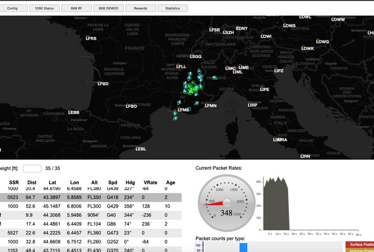
OpenAir Multitrack Receiver
Deploy Avionix's OpenAir multitrack receiver to enhance traffic coverage in your operational area. This professional-grade station tracks multiple protocols over 1090MHz and 868MHz, feeding real-time data into the SafeSky network.
- ADS-B, Mode-S, FLARM (1090MHz)
- ADS-L, OGN, FANET transmission (868MHz)
- Optional Remote ID support
- Plug & play with WiFi or LTE
Built-In Redundancy
SafeSky's multi-source architecture means no single point of failure. If one data source experiences downtime, other compatible networks automatically take over to maintain continuous coverage.
- 30+ independent traffic sources
- Continuous coverage even if sources fail
- Maximizes safety without single point of dependency
Ready to integrate SafeSky?
Start your free trial and experience comprehensive traffic awareness for your drone operations